
Duration
10 Days
![]() Unbeatable Holiday Offers - Save Up to 20% on Your Next Adventure!
Unbeatable Holiday Offers - Save Up to 20% on Your Next Adventure!
Gokyo Valley Trek
Trip Difficulty
EasyMax. Altitude
5357 MetresGroup Size
2-20 PeopleBest Season
Mar-May, Sep-NovTransportation
FlightAccommodation
Teahouse, HotelMeals
Breakfast, Lunch and Dinner- Your safety, our no 1 priority
- Best price guarantee
- Experienced & dedicated team
- Easy booking, no hidden charge
- You can customize this trip

Trip Overview
The Gokyo Valley Trek is one of the most scenic and rewarding trekking journeys in the Everest region of Nepal. It is an ideal option for those trekkers who wish to explore the Himalayas in a quieter and more peaceful environment, without the bustling and noisy Everest Base Camp trail. The trek goes through the beautiful Sherpa village, alpine forests, high mountain valley and over the giant glaciers, and it presents a sight of splendour nearly every single day.
The Gokyo Valley Trek has many highlights, but the most striking among them is the succession of turquoise Gokyo Lakes, which are found deep in the mountains. These lakes are regarded as sacred, and they are located in a dramatic environment with snow-covered mountains.
The trek traces along the border of the Ngozumpa Glacier, which is the longest glacier in Nepal, and this contributes to the untouched and pristine mountainous landscape. On the trail, you go through popular towns such as Lukla, Namche Bazaar, Dole, Machhermo, and Gokyo, where you can enjoy the Sherpa hospitality in the form of traditional tea houses.
The other memorable aspect of the trip is the ascent to Gokyo Ri. The trekkers get one of the best panoramic views of the Himalayas from the top. You can see four of the highest mountains in the world, Mount Everest, Lhotse, Makalu and Cho Oyu that project high above the valleys and lakes below.
Gokyo Valley Trek is classified as a moderate trek and is therefore suitable for beginners and also experienced trekkers. Although there are no technical requirements in climbing, physical preparation and appropriate acclimatisation are significant because of the elevated altitude. The trek is not in a hurry, and the rest days should allow your body to acclimatise safely.
Through Himalayan Pathways, the trek is thoroughly planned and safe, comfortable and an enjoyable experience. With proper acclimatisation, experienced guides, good itineraries, and care, you will not be stressed out by the trip.
Therefore, the Gokyo Valley Trek is an ideal combination of a scenic sightseeing trip, cultural journey, and extreme adventure. It is an amazing alternative to the Everest Base Camp, but a journey to the Himalayas that leaves a lasting impact on your memory even after you come back.
Highlights of Gokyo Valley Trek
- See the Gokyo Lakes that are crystalline, clear turquoise, located very high up in the middle of the Himalayas.
- Visit Gokyo Ri, a phenomenal experience where you can see the Everest, Lhotse, Makalu, and Cho Oyu in all their glory.
- Walk through the huge Ngozumpa Glacier, the longest glacier in Nepal.
- Less crowded and easier trails than the Everest Base Camp.
- Experience traditional hospitality in authentic Sherpa villages.
- Witness the breathtaking sunrise and sunset in the Himalayan Mountain ranges.
- Ideal combination of adventure in the highs, the beauty of nature and cultural experience.
Gokyo Valley Trek Itinerary
This day has an early morning flight from Kathmandu to Lukla (2,840 m / 9,317 ft). It is an exciting 30-minute flight filled with beautiful snowy mountain ranges of the Himalaya, deep valleys, and twisting rivers. On its own, it is an adventure to land in the small Lukla mountain airstrip. Then you have a warm breakfast and meet your guide and trekking team, and you are ready to begin your first day of trekking.
There is no difficult or demanding walk today, just a relaxing one that will accustom one to trekking in the mountains. The path is mild, and then it leads through the Khumbu Valley down to Lukla. You go past stone houses, mani walls, and green fields where people cultivate potatoes and barley.
On this journey, there are various suspension bridges, which are adorned with coloured prayer flags, and they are suspended so high over the Dudh Koski river. Little villages like Chheplung and Thado Koshi provide you with your initial glimpse into the life and culture of the Sherpas.
After 3-4 hours of hiking, you come to a village named Phakding (2,610 m / 8,563 ft), located next to the river. You may have a rest in the afternoon, walk about the village, or pay a visit to a little monastery close at hand. Rest and have dinner in a peaceful teahouse in the evening, and sleep to the running water.
Activity & Duration
Flight + Trekking, 3–4 hrs hikingHighest Altitude
2,840m / 9,318ft (Lukla)Meals
Breakfast, Lunch and DinnerAccommodation
TeahouseYou start your trek after breakfast on the way to Dudh Koshi River, following it upstream. The path is lined by the rich pine and rhododendron woods, the breeze is fresh over the mountain, and the water falls. Entrance to Sagarmatha National Park is at Monjo, where permits are verified. Here, the landscape grows still more dramatic, and there are cliffs and deep gorges.
There are many suspension bridges today, and one of the most popular is called Hillary Bridge, which is suspended over the river and is adorned with prayer flags. The walk is pleasant, but it continues to get tougher with an increase in elevation.
The trail then passes the river at Larja Dobhan, and then the long and steep ascending trail leads to Namche Bazaar. It is the most difficult part of the day, so you move slowly and make frequent stops.
On the ascendancy, at a clear day, you can have your first glimpse of the peaks of Mount Everest (8,848.86 m / 29,031.7 ft), which is lurking over the ridge. This is a new motivation to move on.
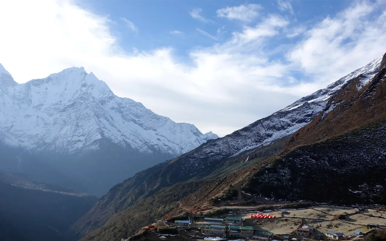
Namche Bazaar (3,440 m / 11,286 ft) is a busy mountain town constructed as a natural bowl, which is reached late in the afternoon. Many shops, bakeries and cafes are found here. And then go to bed after dinner in your teahouse.
Activity & Duration
Trekking, 5–6 hrs hikingHighest Altitude
3,440m / 11,286ft (Namche Bazaar)Meals
Breakfast, Lunch and DinnerAccommodation
TeahouseIt is a big day of acclimatisation to make your body adapt to the elevated altitude. In the morning, you take a hiking trip, a short one up the hill, by the principle of, climb high, sleep low. The path ascends gradually above Namche across pine forest and beyond the Sherpa Museum. Some one hour later, you arrive at the Everest View Hotel (3,880 m / 12,730 ft).
It is a good place to have one of the best panoramic views of the Everest region. During a clear day, Mount Everest, Ama Dablam, Lhotse and Thamserku can be seen soaring against the sky. Balance your time to have a rest, have tea and relax in the landscape.
You can go to the traditional Sherpa villages of Khumjung and Khunde, where you can also visit the Hillary School and local monasteries. A visit to these villages helps you in getting a better insight into the Sherpa culture and life.
After exploring, you go down to Namche Bazaar to have lunch. Afternoon is at liberty to rest or visit the town. You can go to the local markets, have some fresh bakery products, or just relax. This active rest day allows your body to adjust, and will get you well prepared for the new elevations that are on your way.
Activity & Duration
Acclimatisation Hike, 4–5 hrs hikingHighest Altitude
3,880m / 12,730ft (Everest View Hotel)Meals
Breakfast, Lunch and DinnerAccommodation
TeahouseLeaving Namche, you start the hike on the Gokyo Valley trail that is more peaceful. The path starts with a gradual inclination with great scenery of Everest, Ama Dablam and Lhotse. After some hours, you arrive at Sanasa, and you leave the popular trail of Everest Base Camp.
An extreme ascent into the forest leads you to a scenic ridge, called Mong La (3,970 m / 13,025 ft), and is characterised by a stupa. At this point, you get panoramic scenes of deep valleys and snow-covered mountains in the distance. It then turns down to Phortse Thanga (3,680 m / 12,073 ft), a small settlement along the river where you pause and have lunch.
Later in the afternoon, the path ascends again through another thick rhododendron and alpine woods. It is not an easy walk but very quiet, and one can encounter wildlife, including musk deer or colourful birds of the Himalayas. At the higher level, the trees become dispersed, and open areas are formed.
Towards the end of the afternoon, you reach the small village of Dole (4 110 m, 13 484 ft), which is encircled by the grazing of the yaks. Have a nice dinner and a peaceful evening in the mountains.
Activity & Duration
Trekking, 6–7 hrs hikingHighest Altitude
4,110m / 13,484ft (Dole)Meals
Breakfast, Lunch and DinnerAccommodation
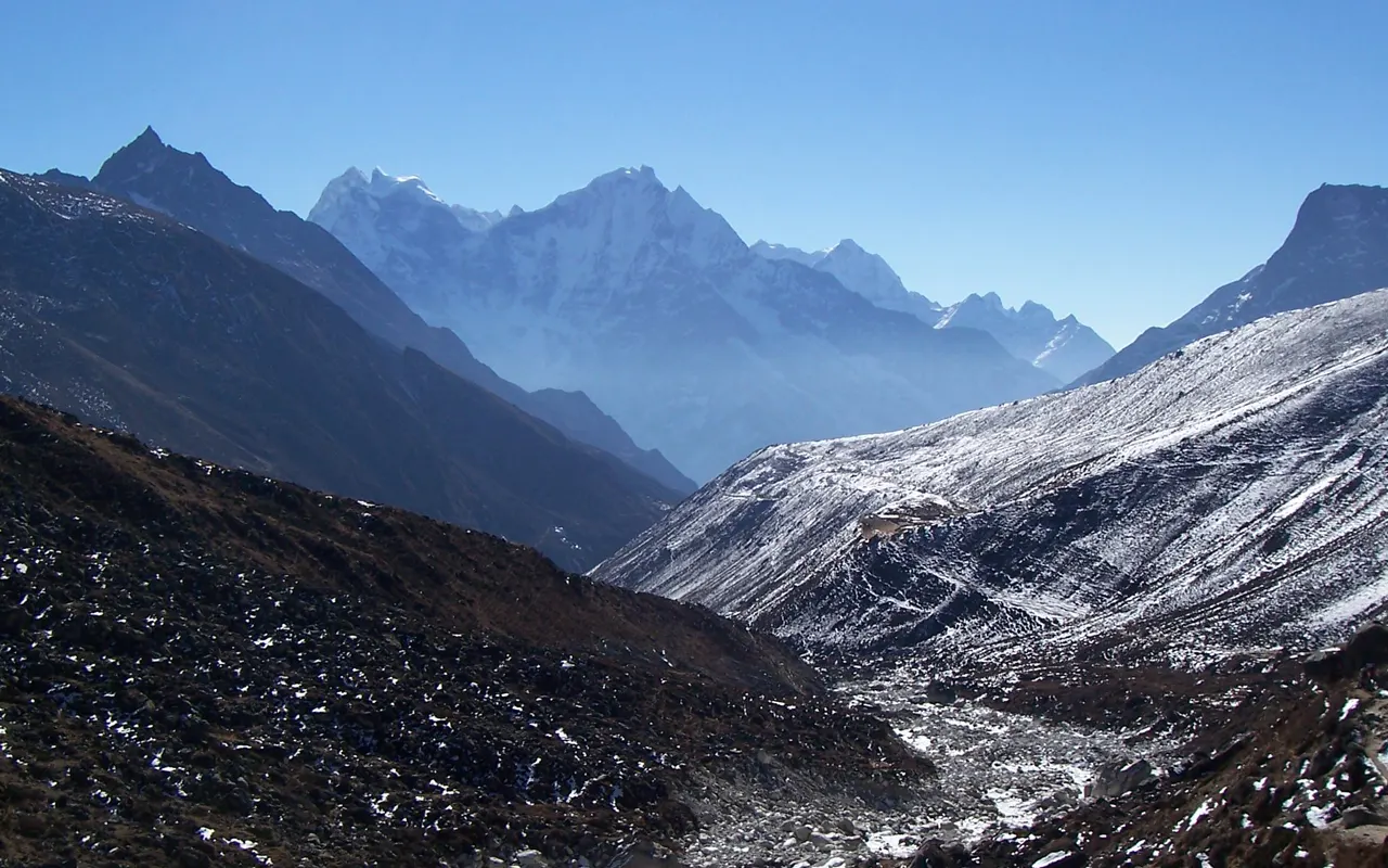
TeahouseThe day’s walk is shorter, although it brings you even closer to the alpine geography. You leave Dole after breakfast and take a constant upward path, through open valleys and low shrubs. It is more rugged in the scenery, and has broad prospects of snow-covered mountains and rocky hills. When walking, one can easily notice Cho Oyu (8,188 m / 26,864 ft) taking over the skyline to the north.
You cross small seasonal villages such as Lhabarma and Luza, where the yak herders rest when the animals are grazing. The prayer flags are dancing in the wind, and little streams are flowing across the road. The atmosphere is more serious, so it is necessary to walk slowly and consume a lot of water. You hear the flow of the Dudh Koshi River way down the cliff, and you start to remember how far you have hiked.
After some hours (approximately 4-5 hours), you come to Machhermo (4,470 m / 14,665 ft). It is a small village with high ridges and has a legend of a sighting of a yeti many years back. During the afternoon, it is possible to rest, visit the valley or participate in a brief lecture about the effect of altitude sickness in the local clinic (depending on its availability). Spend the cosy evening, hot food and a star-shine sky and get ready for the days in front.
Activity & Duration
Trekking, 4–5 hrs hikingHighest Altitude
4,470m / 14,665ft (Machhermo)Meals
Breakfast, Lunch and DinnerAccommodation
TeahouseThe day is very special, and you finally reach the beautiful Gokyo Lakes. Having taken breakfast in Machhermo (4,470 m / 14,665 ft), you begin walking along a rising trail. The first part ascends a little ridge, with a beautiful view down the valley, and Machhermo way below. The view becomes more alpine, open, and rocky, with sparser vegetation and greater vistas, as you go on.
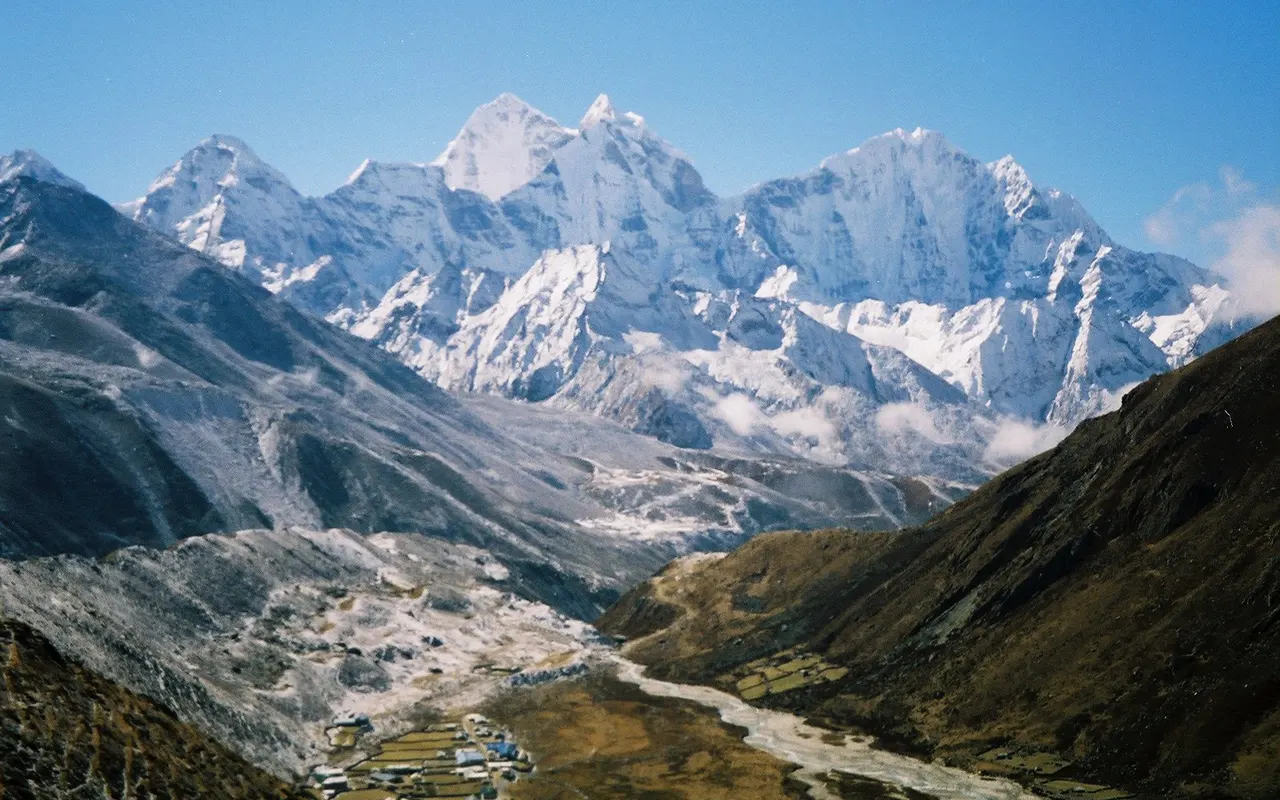
It is a path along the border of the huge Ngozumpa Glacier, the longest glacier in Nepal. Its grey, icy surface extends to your right and well into the distance past the slopes of Cho Oyu (8,188 m / 26,864 ft). It is empowering to walk by this glacier. Before long, you have arrived at the First Gokyo Lake (approximately 4,700 m / 15,420 ft), which is a small yet beautiful lake with barren hills around it.
The walk leads you to the Second Lake, and the water is a gorgeous green-blue. Considering that you are climbing the mountain slowly, you finally reach the Third Lake, the Dudh Pokhari, the primary and most beautiful Gokyo Lake. Immediately next to it is the Gokyo village (4,790 m / 15,715 ft). You could walk around the lake, have Cho Oyu reflections, and relax after lunch and rest before an early night.
Activity & Duration
Trekking, 4–5 hrs hikingHighest Altitude
4,790m / 15,715ft (Gokyo village)Meals
Breakfast, Lunch and DinnerAccommodation
TeahouseThis day begins very early, before sunrise. It is approximately between 4:30 and 5:00 AM when you start ascending Gokyo Ri (5,357 m / 17,575 ft), and headlamps are used to illuminate the way. It is a rocky slope of steep ups and downs winding up the trail. You walk at a slow pace, making pauses and breathing steadily in the cold mountain air.
It takes 1.5-2 hrs to reach the peak just as the sun breaks out. The sight is simply unforgettable. Before you are four of the tallest mountains in the world: Everest, Lhotse, Makalu and Cho Oyu. The turquoise Gokyo Lakes shine to perfection below, and the Ngozumpa Glacier passes through the valley. You take photographs, savour the moment and are proud of this accomplishment.
You come back to Gokyo village, have a late breakfast, and carefully descend. Once packed, you begin the great walk down. You cross the lakes and walk back through Machhermo (4,470 m / 14,665 ft). The lower you descend in altitude, the easier it is to walk. Towards the end of the afternoon, you make it back to Dole (4,110 m / 13,484 ft) to get a much-deserved rest and dinner.
Activity & Duration
Hiking + Trekking, 7–8 hrs hikingHighest Altitude
5,357m / 17,575ft (Gokyo Ri)Meals
Breakfast, Lunch and DinnerAccommodation
TeahouseYou go on with the descent towards Namche Bazaar after breakfast in Dole (4,110 m / 13,484 ft). The path is down a steep, open valley and into pine and rhododendron woods. It becomes easier to breathe, you lose the elevation, and your energy begins to come back.
You pass on to Phortse Thanga (3,680 m / 12,073 ft) across the Dudh Koski River on a suspension bridge. Starting here, the path ascends a little way to Mong La (3,970 m / 13,025 ft), upon which you may pause and have one last panoramic view of the mountains about you. The trail goes downwards to Sanasa and Khumjung.
Approaching Namche, the way is smoother and broader. After spending time in smaller towns, you will be glad to go back to the bustling town. In the early afternoon, you reach Namche Bazaar (3,440 m / 11,286 ft). The remainder of the day will be a day of rest.
Have a hot shower, bakery food, coffee, or even shop for souvenirs. It is now much easier to walk around Namche after being at high altitudes. During the evening, have dinner and tell the stories of the trek with your group.
Activity & Duration
Trekking, 5–6 hrs hikingHighest Altitude
4,110m / 13,484ft (Dole)Meals
Breakfast, Lunch and DinnerAccommodation
TeahouseToday is your last day of trekking. The long walk back to Lukla starts after breakfast in Namche Bazaar (3,440 m / 11,286 ft). The path is steep at the beginning of the descent, and one should take care over it. You turn back on the Dudh Koshi River and pass over high suspension bridges, where the prayer flags are hung.
The further you go down, the greener the surroundings. You walk by the well-known towns like Monjo, where you leave Sagarmatha National Park, and Jorsalle. Lunch is typically done in Phakding (2,610 m / 8,563 ft). Being downhill in most places, the trail is easier to walk; however, it may be exhausting to the knees.
The last part comprises a peaceful hike up to Lukla (2,840 m / 9,317 ft). By afternoon, you come to the town in which you started on your trek. Have a celebratory dinner with your guide and trekking crew in the evening. It is one of those moments when you should appreciate the team, laugh and simply remember the wonderful trip you had along the Gokyo Valley.
Activity & Duration
Trekking, 7–8 hrs hikingHighest Altitude
3,440m / 11,286ft (Namche Bazaar)Meals
Breakfast, Lunch and DinnerAccommodation
TeahouseToday ends your Gokyo Valley Trek adventure in the Himalayas. You get up in Lukla (2,840 m / 9,317 ft), take breakfast and travel to the airport. The flight back to Kathmandu (1,400 m / 4,593 ft) takes a small mountain plane, weather permitting.
Departure from the short runway of Lukla is a very exhilarating experience, and before long, you are flying above hills, rivers and the final glimpses of the Himalayas.
The flight lasts approximately 35 minutes and provides you with one last tour of the mountains that you have just hiked. On arrival at Kathmandu, you are taken to the hotel. The busy city is vibrant and alive after several days of walking.
The trek comes to an end today. You can either relax, shop or even sightsee in Kathmandu at your own speed. WE set up a farewell dinner in the evening, where you get to savour traditional Nepali cuisine and cultural shows. It is an ideal ending to your successful Gokyo Valley Trek and bidding your farewells to new friends. You leave Nepal with memories that are unforgettable and a feeling of accomplishment.
Activity & Duration
Flight & Departure, 0.6 hrs flightHighest Altitude
2,840m / 9,318ft (Lukla)Meals
Breakfast, Lunch and DinnerAccommodation
HotelPrice Includes and Excludes
What is included?
- Kathmandu Airport pick-up and drop-off.
- Flight to and from Kathmandu (or Manthali/Ramechhap) to Lukla (inclusive of taxes).
- Kathmandu to Ramechhap in a private vehicle, if necessary.
- Certified English-speaking guide (all guide fees included).
- Accommodation in a tea house in the trek (twin-sharing).
- Every meal during the trek: dinner, lunch, breakfast (with simple tea/coffee).
- All necessary permits: Sagarmatha National Park and Khumbu Pasang Lhamu permit.
- First aid kits and pulse oximeters.
- Drinking water during the trek (purification pills/drops and/or filtered refill package).
- Trek map for each trekker.
- Duffel bag, sleeping bag, down jacket, trekking poles if needed (returnable after the trek)
- Guide/porter staff insurance.
- Porter service upon pre- booking (15 kg/per person).
- Any government tax and service fee.
What is not included?
- Nepal visa fee.
- International flights to/from Nepal.
- Travel insurance (has to be high-altitude and helicopter rescue).
- Hotel and meals in Kathmandu and before/after the trek.
- Additional beverages and snacks (bottled water, soft drinks, alcohol, additional tea/coffee).
- Personal expenses like Wi-Fi, charging, hot showers, laundry, phone calls, and shopping.
- Additional accommodation and dinner because of flight delays, cancellations or alterations.
- Porter cost if not pre-booked.
- Guide, porter and driver tips.
- Nepal optional tours/activities.
- Your personal hiking equipment (shoes, clothes, rucksack, etc.).
- Any fee not in the listing of Includes.
Trip Information
Trek Difficulty
Gokyo Valley Trek is a moderate trek that has some challenging moments, though it can be done by the majority of people with good fitness. Climbing skills are not necessary since the path is easy to follow through the mountain trails. But you will come on rocky ways, sharp up and down, and steep steps. The average time spent on hikes is 5-7 hours on most days, and thus endurance is important.
The greatest difficulty is altitude. You sleep up to Gokyo village (4,790 m / 15,715 ft) and ascend to Gokyo Ri (5,357 m / 17,575 ft), where it is very thin in the air and climbing is more difficult. The Gokyo Valley Trek is quite attainable and rewarding with proper timing, rest, and hydration.
Himalayan Pathways offer well trained guides who will assist you to maintain a safe pace and acclimatise to the altitude.
Weather and Best Season
The Everest region experiences a lot of change in the weather, and hence timing is a factor in the Gokyo Valley Trek. The spring period (March-May) and autumn period (September-November) are the best seasons. During these months, the sky is normally clear, and mountain views are at their optimum.
In spring, it is somewhat warmer and bright, and on lower trails, rhododendrons are blooming, whereas in high places, such as Gokyo (4,790 m / 15,715 ft), are cold at night. October is a month with beautiful visibility and clean air.
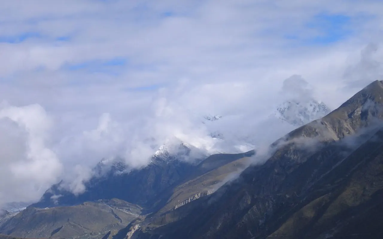
The rain, clouds, trails that can get slippery, and possible flight delays are present in the monsoon (June-August), but there are fewer crowds. The season of winter (December-February) is a quiet time with clear skies, but the temperatures are very low in high places such as Gokyo (4,790 m / 15,715 ft).
Food & Drink During the Trek
The food on the Gokyo Valley Trek is basic, comforting, and nutritious, which is ideal for enduring the long days of hiking. You dine in teahouses, and meals are cooked fresh and primarily carbohydrate-rich to provide energy.
The dish that most people prefer is the dal bhat (rice, lentil soup, vegetables), as it gives you enough strength to continue on the trek. There will also be noodles (thukpa), momos, fried rice, pasta, eggs, soups, and porridge. Bakeries with bread, cakes and coffee exist in larger locations, such as Namche Bazaar (3,440 m / 11,286 ft).
Consume as much water and hot tea as possible, such as ginger or lemon honey, which works well at altitude. Refilling a reusable bottle with boiled or filtered water is best, rather than purchasing plastic bottles.
Altitude Sickness and Suggestions
The altitude is a severe consideration during the Gokyo Valley Trek, as you will be staying several days at 3,500 m / 11,483 ft and ascending Gokyo Ri (5,357 m / 17,575 ft). At high altitude, oxygen is less, hence you might get fatigued, short of breath or headaches.
Light symptoms may be eased through rest, water intake, and a slow pace. Gradual ascent and drinking 3-4 litres a day, having good meals and no alcohol at higher villages such as Machhermo (4,470 m / 14,665 ft) and Gokyo (4,790 m / 15,715 ft) is the best method of prevention.
In case the symptoms become more severe, like vomiting, intense headache, confusion, difficulty in breathing, get down to the lower elevation. Himalayan Pathways guides are trained and made to exercise maximum attention to the health of the altitude and to act promptly. Through intelligent acclimatisation and effective communication, the majority of individuals make it safely and joyfully through the Gokyo Valley Trek.
Preparation and Fitness
The Gokyo Valley Trek becomes more pleasant and comfortable with good preparation. To achieve endurance, activate walking, hiking, jogging, cycling or swimming 8-12 weeks before your trip. Train legs by walking uphill and up the stairs, as the trail has steep ascents and descents.
Incorporate simple strength exercises such as squats, lunges, and step-ups and core exercises to ensure balance and comfort of the backpack. Wear in your hiking shoes before they set in to prevent blisters. Wear and pack layered clothes because mornings and evenings are cold, particularly around Gokyo (4,790 m / 15,715 ft).
It is important to bring gloves, a warm jacket, sunglasses and a headlamp when making early starts such as the hike to the Gokyo Ri (5,357 m / 17,575 ft). Himalayan Pathways is also able to assist with gear advice and rentals. Being fit and having the right attitude, the Gokyo Valley Trek will be an easy challenge.
Visa and Permits
To complete the Gokyo Valley Trek, you require a Nepal tourist visa and local trekking permits. The majority of the travellers receive a visa at Kathmandu airport upon presenting a valid passport (at least 6 months’ validity) and a photo.
To trek, you require the Sagarmatha National Park Permit and the Khumbu Pasang Lhamu Rural Municipality Permit. These are inspected on the road, in particular near Monjo and Namche Bazaar (3,440 m / 11,286 ft).
The permit arrangements are done by Himalayan Pathways, so when you are on the trail, you do not have to worry about the paperwork. All you need to do is carry a copy of your passport and keep your stuff secure. You will not have to worry about getting a visa and permits, and, instead, you can enjoy the scenery, villages, and high lakes of the Gokyo Valley Trek.
Health & Safety
The Gokyo Valley Trek is a very sensitive area in terms of health and safety since you are in remote mountainous areas and at high altitude. Before travelling, complete a simple medical check-up and carry along your personal medicines. Carry basic first aid such as blister pads, pain medication and stomach medicine.
To prevent stomach issues, drink only boiled or filtered water and wash your hands frequently. The safety of the trail is also important, so wear good boots, walk along marked trails, and avoid yaks and mules.
Above Namche Bazaar (3,440 m / 11,286 ft) and around Gokyo (4,790 m / 15,715 ft), altitude safety is important, and symptoms should be reported at an early stage and walk slowly.
The weather is unpredictable, and you should bring a rain jacket and warm layers of clothes with you. Himalayan Pathways guides will assist you with route directions, first aid, and altitude consciousness to make you feel safe and assured during the trek to Gokyo Valley.
Transportation
The Gokyo Valley Trek normally begins with a flight to Lukla (2,840 m / 9,317 ft), and then the trek starts. It takes a short yet scenic flight to the hills and the Himalayan mountains. Flights during busy seasons might be flown from Ramechhap (Manthali) rather than Kathmandu, which will require the first road drive.
The weather in the mountains may delay or cancel flights, and thus it is prudent to add a buffer day following the trek.
On the trek itself, there is no road, and everything is by foot, and the logistics are carried by yaks and porters.
Himalayan Pathways will handle your flights, airport transfers, and other necessary road transportation; thus, you do not have to handle logistics. The mountain adventure is easily concluded at the end of the Gokyo Valley Trek with the flight back to Lukla (2,840 m / 9,317 ft) to Kathmandu.
Travel Insurance
Travel insurance is necessary in the Gokyo Valley Trek since you trek to high altitudes and remote places. You should have a policy of trekking to at least heights of 5,500 m / 18,045 ft because the Gokyo Ri is at 5,357 m / 17,575 ft. Above all, it should feature evacuation by helicopters in the event of an emergency and medical care. The cost of a helicopter rescue in the Everest area may be enormous; appropriate coverage will save you from massive expenses.
Your insurance should also assist in the delay of a trip, particularly in Lukla flights, and may additionally finance lost baggage or additional hotel accommodation.
Bring a copy of your policy and emergency contacts on the trek. The Gokyo Valley Trek can be taken without any worry with proper insurance.
Alternative Routes
The Gokyo Valley Trek is itself beautiful; however, there exist great alternative paths for those who want a bit of adventure.
One of the most frequently used choices is to hike Gokyo and cross Cho La Pass (5,420 m / 17,782 ft) to join the Everest Base Camp, which makes the trip longer and more difficult.
The other great option is the crossing of Renjo La Pass (5,360 m / 17,585 ft) that creates a loop to Namche Bazaar, and provides overlooks the Gokyo Lakes.
In case you are not in a hurry, a side walk to the Fourth and the Fifth Lakes by the Gokyo village (4,790 m / 15,715 ft) is also worthwhile.
Himalayan Pathways can design these trails according to your fitness, time, and acclimatization and transform your Gokyo Valley Trek into something more unique.
Your Extra Expenses
Though the Gokyo Valley Trek package includes major expenses, you need to budget for personal expenses. These will be your Nepal visa, Kathmandu hotel and food, snacks, beverages, Wi-Fi, hot showers, charging devices and souvenirs. Prices increase with altitude, particularly around Gokyo (4,790 m / 15,715 ft), where the bottled water and charging are more expensive.
Porters and guides are expected to be tipped. There might also be additional money required due to flight delays in Lukla (2,840 m / 9,317 ft). Always bring as many Nepali rupees as you can from Kathmandu, because ATM is no reliable ATMs after that.
Language & Communication
The Gokyo Valley Trek has a large number of English-speaking guides, lodge owners and trekking staff. This ensures that most visitors find it simple to communicate. The Sherpa people have their own language, but Nepali is commonly spoken. The guides will help you translate the language if necessary. Most of the menus and signboards are in Nepali and English, so there is no issue regarding language and communication in this trek.
Dhanyabad (thank you) and Namaste (hello) are simple words that are welcome. Always greet people with a smile on your face and be courteous.
Having Himalayan Pathways guides will assist in maintaining contact and keeping you informed throughout the Gokyo Valley Trek, and also aid in communication where necessary.
Mobile Network, Internet and Charging facilities
On the Gokyo Valley Trek, the mobile network functions well until Namche Bazaar (3,440 m / 11,286 ft). After that, the coverage becomes unavailable or weak. The majority of trekkers rely on paid Wi-Fi internet at tea houses in even higher villages such as Gokyo (4,790 m / 15,715 ft).
The phones and cameras can be charged, but it will be an additional fee, and at high altitudes, the prices are high. Solar power is the primary source of electricity and is therefore not always available. It is quite convenient to have a power bank.
Cold temperatures consume batteries very fast, hence keep devices warm. This piece of advice can be applied to the Gokyo Valley Trek, which helps prevent the misuse of power and connection.
Don’ts on This Trip
Do not overlook the symptoms of altitude, particularly above Namche Bazaar (3,440 m 11,286 ft) or near Gokyo Ri (5,357 m 17,575 ft). Do not litter or pollute trails, rivers or holy Gokyo Lakes. Do not be disrespectful of culture. Ask permission before taking pictures, and put on modest clothes in monasteries.
Do not go off track or neglect the counsel of your guide. Consuming alcohol and smoking in high elevations is unsafe.
Do not bring or fly drones without authorisation. Himalayan Pathways focuses on responsible trekking to enable you to conserve nature, observe the local culture, and be safe during the Gokyo Valley Trek.
Trip Extension
Once you have finished the Gokyo Valley Trek, the next destination for many travellers is to travel further in Nepal. Cultural tours in Kathmandu Valley, wildlife safaris in Chitwan National Park, and rest by the Phewa Lake in Pokhara are some of the popular options.
The adventure lover can go rafting, paragliding or do a scenic helicopter flight in the Everest. In case you want to explore the mountains more, you can travel further or take a small hike in Namche Bazaar (3,440 m / 11,286 ft) nearby.
These extensions make your Gokyo Valley Trek even more fulfilling, naturally and culturally. The trek can be followed by extensions planned by Himalayan Pathways, that is, depending upon your time, energy, and interests.
Photography & Drone Rules
The Gokyo Valley Trek is the dream of photographers, which provides lakes, glaciers, and the Himalayan mountains. You can take landscape shots and follow-up shots.
Never take pictures of local people without their consent or in monasteries. Don’t use inside the monasteries or on people’s faces. Gokyo Ri (5,357 m / 17,575 ft) is particularly popular at sunrise, so you can capture the rays of the sun touching the mountains and painting the sky with hues of aesthetic.
Drones are highly prohibited in Sagarmatha National Park. One should have a special license to fly, and failure to fly with permits and use of a drone may result in seizure. Himalayan Pathways highly discourages the carrying of drones. Phones and cameras will be sufficient to document the memories of the Gokyo Valley Trek.
Cultural Festivals on the Trail
Everest is a culturally rich area with Sherpas, and at times, you are likely to experience festivals in or close to the Gokyo Valley Trek. The most well-known Sherpa festival is Mani Rimdu, which is celebrated either in October or November in Tengboche Monastery.
In early summer, in Sherpa villages such as Namche Bazaar (3,440 m / 11,286 ft), the Dumji Festival is celebrated.
Losar is the Tibetan New Year, which occurs during winter. Without festivals, however, there will be prayer flags, mani walls and daily practices on the path to Gokyo (4,790 m / 15,715 ft).
The Himalayan Pathways guides describe the local culture, which makes the experience of the Gokyo Valley Trek more cultural.
Tips for First-Time Nepal Visitors
When you are in Nepal, be open and patient; this is your first visit there. It is a slower place to live, and flexibility is a virtue here, particularly when flying into the mountains to Lukla (2,840 m / 9,317 ft).
Wear simple clothes, greet with Namaste, and adhere to local traditions. Drink only purified, bottled, boiled or treated water, and cash is necessary, because ATMs are very scarce after Namche Bazaar (3,440 m / 11,286 ft).
The Gokyo Valley Trek should be expected to be simple in terms of the living conditions, particularly around Gokyo (4,790 m / 15,715 ft). The language is English, with the locals being very accommodating. First-time tourists are normally made to feel safe and at home in Nepal with the directions of the Himalayan Pathways.
Frequently Asked Questions
How long will the Gokyo Valley Trek last?
The average Gokyo Valley Trek will take approximately 10 days, including the acclimatisation and travel days.
What is the level of difficulty of the Gokyo Valley Trek?
Gokyo Valley Trek is said to be moderately difficult and to be taken by fit trekkers, even the first time high-altitude trekkers who are well-prepared.
What is the highest elevation level of the Gokyo Valley Trek?
The highest point is Gokyo Ri with a height of 5,357 m / 17,575 ft.
What is the most appropriate time of the year to do the Gokyo Valley Trek?
Spring (March- May) and autumn (September- November) are the most favourable seasons because the weather is stable and clear in the mountains.
Do we need trekking permits for the Gokyo Valley Trek?
Yes, Sagarmatha National Park and Khumbu Pasang Lhamu permits are mandatory and are organised by Himalayan Pathways.
What category of accommodation is offered in the trek?
Trekkers will be accommodated in local tea house lodges with simple yet comfortable facilities on twin sharing basis.
Does it have meals as part of the Gokyo Valley Trek?
Indeed, the trekking days have three meals a day: breakfast, lunch, and dinner.
Is travel insurance necessary for this trek?
Yes, high-altitude trekking plus emergency helicopter evacuation travel insurance is required.
Does the trek cost include flights to Lukla?
Yes, Kathmandu (or Manthali) to Lukla round-trip domestic flights are included in the package.
Is it possible to customise or prolong the Gokyo Valley Trek?
Yes, Himalayan Pathways will be able to tailor the trek or mix it with other treks, such as the Everest Base Camp or Renjo La Pass.
Reviews on Gokyo Valley Trek
- Your safety, our priority
- Best price guarantee
- Experienced & dedicated team
- Easy booking, no hidden charge
- You can customize this trip