Duration
13 Days
![]() Unbeatable Holiday Offers - Save Up to 20% on Your Next Adventure!
Unbeatable Holiday Offers - Save Up to 20% on Your Next Adventure!
Langtang Gosaikunda Trek 13 days
Trip Difficulty
ModerateMax. Altitude
4610 MetresGroup Size
2-20 PeopleBest Season
Mar-May, Sep-NovTransportation
FlightAccommodation
Teahouse, HotelMeals
Breakfast, Lunch and Dinner- Your safety, our no 1 priority
- Best price guarantee
- Experienced & dedicated team
- Easy booking, no hidden charge
- You can customize this trip

Trip Overview
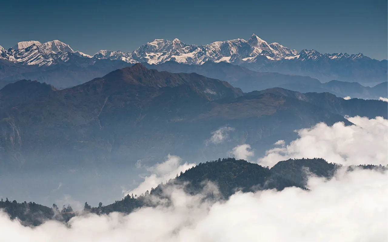
The Langtang Gosaikunda Trek is one of Nepal’s most rewarding trekking journeys, offering a perfect mix of mountain scenery, sacred landscapes and rich local culture. North of Kathmandu, this trek is a gateway into the Langtang region, a land of the high Himalayan range, calm valleys, and hospitable mountain villages.
The Langtang Gosaikunda Trek is less crowded and more personal, which makes it a great option among the trekkers who seek adventure and an authentic experience.
The journey starts with a picturesque drive from Kathmandu to Syabrubesi, the entrance to Langtang Valley. The drive takes you through the rushing rivers and deep woods, and small villages, gradually ascending to greater heights. You pass through bamboo, pine, and rhododendron forests, birds and wildlife.
When the valley expands, the tall mountains, including Langtang Lirung, take control of the skyline. The Buddhist influence of Tibetans in the area is very strong, as manifested in traditional stone buildings, prayer flags, mani walls, and monasteries.
The Kyanjin Gompa is the best part of the trek, where one will get close-up views of the mountain with the opportunity of visiting the yak cheese factories and monasteries in the area.
The Langtang Gosaikunda Trek is completed after a visit to Langtang Valley and heads towards the sacred lakes of Gosaikunda. This part is more alpine and distant, with expansive scenery and less foliage. Gosaikunda Lake is one of the sacred places of Hindus and Buddhists, and it is the place that attracts pilgrims all over Nepal during the religious festivals.
The most incredible experience of the trek is the crossing of the high Laurebina La Pass that offers spectacular views and gives a great sense of accomplishment. That path goes down to the Helambu area, a peaceful land of villages and soft hills, and close to Kathmandu Valley.
The Langtang Gosaikunda Trek is a good option where the trekkers get a variety without involving technical climbing. It presents shifting scenery, cultural richness, and challenges that are not too demanding, all this within a relatively short distance of Kathmandu.
However, you need a skilled team, a precise itinerary, and the ability to choose the most suitable routes to see the Himalayas as comfortably and securely as possible. Himalayan Pathways is capable of providing you with the necessary experience to enjoy the journey to the fullest, each step of the ultimate Himalayan adventure.
Highlights
Highlights of Langtang Gosaikunda Trek 13 days
- Explore the beautiful Langtang Valley and have a close-up shot of snow-capped Himalayan mountains.
- Feel the calm and religious values of the holy Gosaikunda Lake.
- Climb the high Laurebina La Pass and experience breath-taking mountain views and a sense of accomplishment.
- Explore traditional Tamang villages full of culture, monasteries and prayer flags.
- Sightsee green forests and alpine regions, and mountain rocky areas.
- Eat local delicacies such as fresh yak cheese in the mountain villages of Kyanjin Gompa.
- Take a less-travelled trail near Kathmandu that is adventurous yet not crowded.
Langtang Gosaikunda Trek 13 days Itinerary
The trek starts with a lovely drive early in the morning from Kathmandu (1,400 m / 4,593 ft) to Syabrubesi (1,503 m / 4,931 ft). The highway passes through green mountains, terraced agricultural lands and tiny villages.
On its path, you follow the Trishuli River and have views of Ganesh Himal, and, on clear days, distant views of Annapurna and Manaslu. The road is approximately 7-8 hours long, and along the way are vibrant towns like Trishuli Bazaar and Dhunche, providing a glimpse into the life of the Nepali people.
At the end of the afternoon, you reach Syabrubesi, a bustling village at the gateway of Langtang National Park. Once you settle into a local teahouse, it is possible to walk a little bit in the village or enjoy the river. Take a warm dinner and rest for the night.
Activity & Duration
Drive, 7-8 hours driveHighest Altitude
1,503m / 4,931ft (Syabrubesi)Meals
Breakfast, Lunch and DinnerAccommodation
TeahouseIt is your first trekking day today. After breakfast, cross a suspension bridge and start walking towards Langtang Khola. The path runs through beautiful forests with bamboo, oak and rhododendron trees. The trail consists of long ascents, abrupt climbs and some landslides which require some special attention.
Through small villages such as Bamboo and Pahiro, where you can take a short stop and have tea. Birds abound in the forest, and you can see langur monkeys in the trees. Waterfalls and raging streams also contribute to calmness. Lama Hotel (2,470 m / 8,104 ft) is a peaceful break amidst the trees that you reach after 5-6 hours of walking.
Have a hot meal in the evening and sleep listening to the river near you, preparing for your next day’s adventure.
Activity & Duration
Trekking, 6 hrs hikingHighest Altitude
2,470m / 8,104ft (Lama Hotel)Meals
Breakfast, Lunch and DinnerAccommodation
HotelYou go on with trekking further into the Langtang Valley after breakfast. The path is slowly ascending with pine and rhododendron woodland, cool air and scenic mountain views. The higher you get, the deeper the valley and the less dense the forest. You arrive at Ghodatabela (3,030 m / 9,941 ft) to have a rest and have a glimpse of Langtang Lirung.
The path then goes through the yak fields, prayer flags, mani walls, and chortens, with a high Tibetan Buddhist culture. You can also observe places which have been hit by the earthquake in 2015, and it should remind you of the historical background of the area.
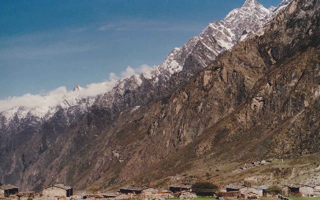
By afternoon, you reach Langtang Village (3,430 m / 11,253 ft), which is rebuilt in traditional stone houses and with warm hospitality. You move around the village, the monastery, and you spend the night in your teahouse.
Activity & Duration
Trekking, 6 hrs hikingHighest Altitude
3,430m / 11,253ft (Langtang Village)Meals
Breakfast, Lunch and DinnerAccommodation
TeahouseIt is a shorter and less strenuous trek today. Leaving Langtang Village, the trail proceeds without any steep uphill, having broad open-fields. The scenery is more Alpine, with less vegetation and more rocky soil. You go over little wooden bridges and pass down long mani walls cut with prayers.
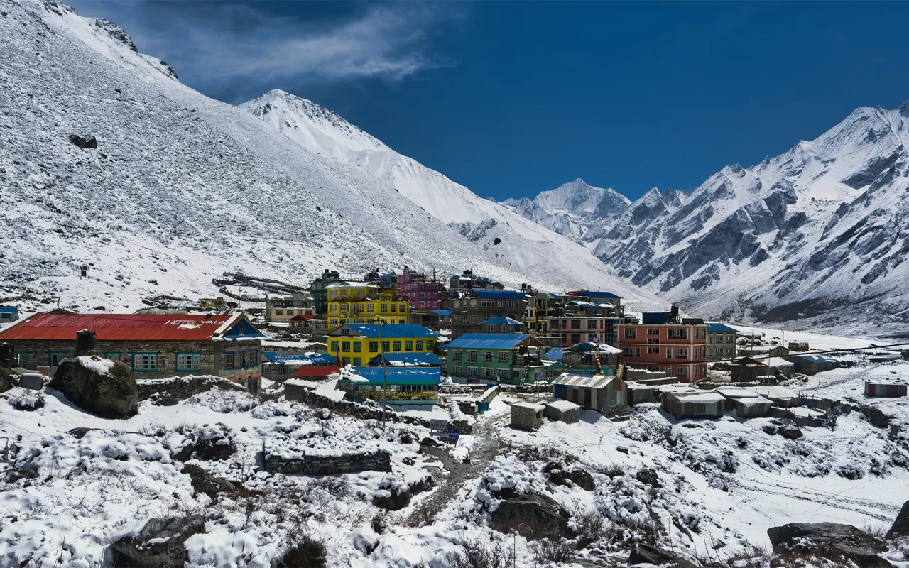
The ascending is steady, creating a comfortable, enjoyable walk. In the afternoon, you arrive at Kyanjin Gompa (3,870 m / 12,697 ft) and are in the presence of snow-covered mountains, including Langtang Lirung and Yala Peak. In the afternoon, you are free to look around.
You may go to the old Buddhist monastery or the factory of yak cheese. The walks around the valley assist in acclimatisation. This is one of those stops that will be remembered due to the serene nature and mountain scenes.
Activity & Duration
Trekking, 4 hrs hikingHighest Altitude
3,870m / 12,697ft (Kyanjin Gompa)Meals
Breakfast, Lunch and DinnerAccommodation
TeahouseToday will be the day of acclimatisation, and a strenuous hike to Tserko Ri (4,984 m / 16,352 ft). You are up early in the morning, and you take a hiking trail that climbs up the mountainous terrain and through the yak grazing fields. It is a tough climb, but it is slow and with frequent rests taken.
About 3-4 hours later, you come to the top of Tserko Ri, the highest point of the Langtang Valley. Panoramic views of Langtang Lirung, glaciers and other Himalayan peaks shining in morning light are all you will get at the top. You then take photos and have some rest, and then carefully descend back to Kyanjin Gompa, where you have a late breakfast.
The remainder of the day is to be spent in rest and mild walking. Exercise, but not strenuous, helps your body to adapt to altitude.
Activity & Duration
Acclimatisation hike, 8 hrs hikingHighest Altitude
4,984m / 16,352ft (Tserko Ri)Meals
Breakfast, Lunch and DinnerAccommodation
TeahouseYou start going down Kyanjin Gompa after breakfast. The route goes through the same route in reverse, through Langtang Village and Ghodatabela. It is easier to walk downhill, and the air is lighter, giving you more power. You cross places that you know, but the perspectives are new to you in this direction.
The path passes through woods, river banks and villages. You have lunch at a teahouse as you pass by. Certain down slopes are sharp, hence proper shoes and support can save your knees. The further down you go, the more vegetation is in the form of greenery.
In the late afternoon, you reach Lama Hotel (2,470 m / 8,104 ft). It is a place to have a rest after a long day, as it is in a peaceful forest environment, with the sound of the river.
Activity & Duration
Trekking, 7 hrs hikingHighest Altitude
3,870m / 12,697ft (Kyanjin Gompa)Meals
Breakfast, Lunch and DinnerAccommodation
HotelYou are now leaving the trail of Langtang Valley and going onto the Gosaikunda trail. The way down from Lama Hotel is short, after which there is a climb through silent woods. You walk across suspension bridges and deep gorges, and you walk through quiet environs with fewer trekkers.
The path runs across terraced farms, small farmhouses, and Tibetan chortens, which indicate Tamang culture. Another sharp incline then leads to Thulo Syabru (2,250 m / 7,382 ft), a ridge village. Here, you are greeted with vast sceneries of green hills and mountains.
Once you have settled into your teahouse, you can do sightseeing around the village or engage in chatting with the people, or watch the sunset. It is a quiet location and the ideal place to relax at the end of the day.
Activity & Duration
Trekking, 6 hrs hikingHighest Altitude
2,470m / 8,104ft (Lama Hotel)Meals
Breakfast, Lunch and DinnerAccommodation
TeahouseThis day’s walk is predominantly uphill, as you will be going out of Thulo Syabru (2,250 m / 7,382 ft) to Sing Gompa (3,300 m / 10,827 ft). The road goes up steadily through quiet pine and rhododendron woods. The mountain air and silence in the surroundings make this a very good trekking day. With elevation, villages and farmland are gradually lost, and in their place, we find thick woods and bare mountain slopes.
As one goes, you pass a few vistas where the trees clear, and there are beautiful panoramas of hills, and above, of snowy mountains in the distance. You can be lucky enough to observe such birds in the Himalayas as the multi-coloured monal, or even mountain goats. It takes approximately 5-6 hours of walking to meet Sing Gompa or Chandanbari.
It is a small village that is known for a Buddhist monastery and a yak cheese factory. You can see both and then rest at the teahouse.
Activity & Duration
Trekking, 6 hrs hikingHighest Altitude
3,300m / 10,827ft (Chandanbari)Meals
Breakfast, Lunch and DinnerAccommodation
TeahouseToday you are going to the holy lakes of Gosaikunda. Leaving Sing Gompa (3,300 m / 10,827 ft), the path ascends gradually to Laurebinayak (3,910 m / 12,828 ft). On clear days, you will have panoramic views of the mountains, including the Langtang and Annapurna Mountain ranges over this ridge. There is less air, and you should walk at a slow pace and take a rest.
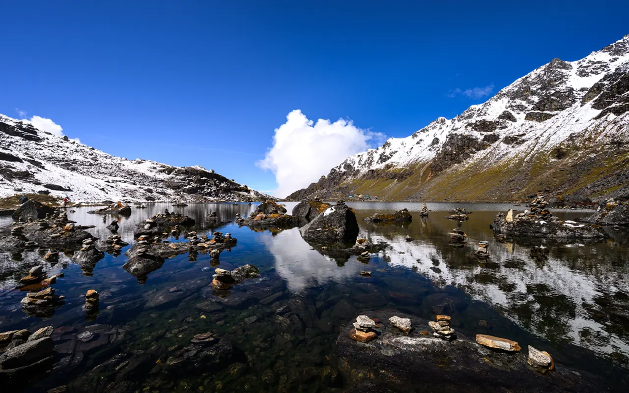
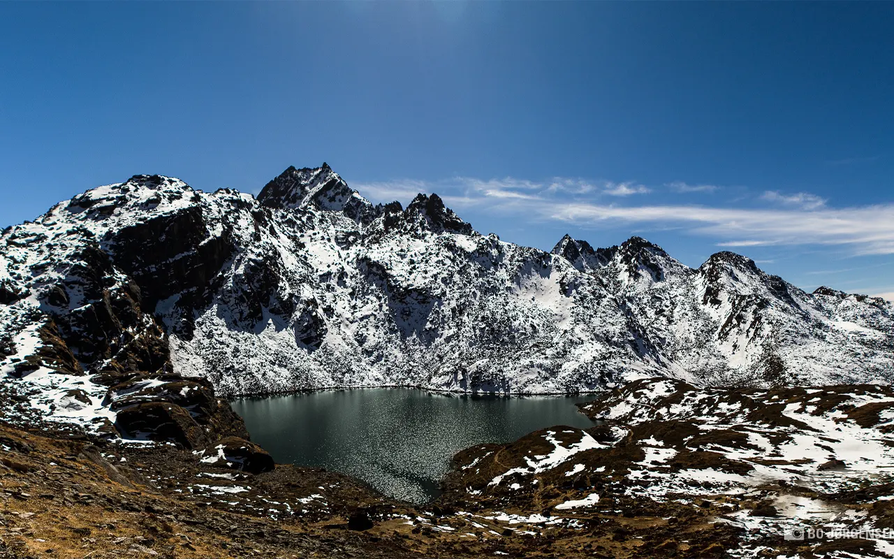
The trail after Laurebinayak leads along a high ridge on which the scenery is dramatic on both sides. Towards the end of the morning, the blue waters of Gosaikunda Lake (4,380 m / 14,370 ft) can be viewed between the Rocky Mountains. This sacred lake is also a major religious attraction to the Hindus and Buddhists.
You spend the night in a teahouse on the shore of the lake. During the afternoon, it is possible to walk around the lakeside and experience the spiritual and quiet atmosphere of the special place.
Activity & Duration
Trekking, 6 hrs hikingHighest Altitude
4,380m / 14,370ft (Gosaikunda Lake)Meals
Breakfast, Lunch and DinnerAccommodation
TeahouseIt is the most exhausting day of the trek. The day begins at a very early hour at Gosaikunda Lake (4,380 m / 14,370 ft) to pass over Laurebina La Pass (4,610 m / 15,125 ft), the highest point of the Langtang Gosaikunda Trek. Climbing up is not easy, and small frozen lakes and rocky slopes are on the way. Deep breathing and walking slowly are useful at this high altitude.
A few hours later, you are at the pass, with prayer flags and amazing mountain scenery. At 4,610 m (15,125 ft), you feel that you really have accomplished something. You get a brief rest, after which you start a long descent by a very rugged road.
As you drop down, the scenery gradually returns to shrubs and forest. Towards the end of the afternoon, you come to Ghopte (3,430 m / 11,253 ft), a small teahouse village in the forest. A hot dinner and a rest are particularly pleasant tonight.
Activity & Duration
Trekking, 8 hrs hikingHighest Altitude
4,610m / 15,125ft (Laurebina La Pass)Meals
Breakfast, Lunch and DinnerAccommodation
TeahouseLeaving Ghopte (3,430 m / 11,253 ft), the present trail passes through forest ridges with several ups and downs. Then there is an initial ascent to Thadepati (3,690 m / 12,106 ft), a high crossroads with excellent views in the direction of the mountains. It is among the final destinations where you can see the snowy peaks in clear view and then proceed southwards.
Out of Thadepati, the road descends continuously through rhododendron woods and exposed yak grazing lands like Mangengoth. The air grows warmer, and the path is easier. You pass silent clearances and small villages on the way.
You get to Kutumsang (2,470 m / 8,104 ft), a terraced village on a hillside, by the early afternoon. This region is a part of the Helambu region, where the local culture and village life are a bit different. You spend your night in a teahouse and have a pleasant evening.
Activity & Duration
Trekking, 5 hrs hikingHighest Altitude
3,690m / 12,106ft (Thadepati)Meals
Breakfast, Lunch and DinnerAccommodation
TeahouseThis is the last day of trekking you have. The trail starts at Kutumsang (2,470 m / 8,104 ft) and proceeds along ridges and low hills, passing through fields and woods. You pass by the small villages like Gul Bhanjyang and Chipling, where the local life is maintained at a slow pace. Rest stops on the way are opportunities to have a rest and communicate with the villagers.
The trail goes up and down, so there is no strenuous walking. The closer you get to Kathmandu Valley, the more the mountainous sceneries disappear and the more the towns become noticeable. During the afternoon, you arrive at Chisapani (2,165 m / 7,103 ft), a village on the summit of the ridges, known as a viewpoint.
On a sunny day, you will be able to view the Langtang range and Ganesh Himal to the north and Kathmandu Valley to the south, which is very wide. You spend the night in a teahouse and have your final sunset on the trail.
Activity & Duration
Trekking, 7 hrs hikingHighest Altitude
2,470m / 8,104ft (Kutumsang)Meals
Breakfast, Lunch and DinnerAccommodation
TeahouseThe last day starts with a walk downhill from Chisapani (2,165 m / 7,103 ft). The path leads to Shivapuri National Park and goes down through the thick forest with birds and running streams. The walk is generally downwards and not as tiring to the lungs, but in some parts it may be steeper.
Sundarijal (1,460 m / 4,790 ft) with its fresh water and little falls appears after approximately 4-5 hours. This is where your trekking life comes to an end. Here you drive back to Kathmandu, and this can take an hour.
With the city life slowly coming back, you can contemplate the long trip made in the mountains, forests, and holy lakes. It is satisfying to arrive in Kathmandu after days of being in isolated landscapes.
Activity & Duration
Trekking and Drive, 5 hrs hikingHighest Altitude
2,165m / 7,103ft (Chisapani)Meals
Breakfast, Lunch and DinnerPrice Includes and Excludes
What is included?
- Pick-up and drop off at Kathmandu Airport by a private vehicle.
- Transportation from Kathmandu to Syabrubesi (public bus or shared jeep) at the start of the trek.
- Sundarijal to Kathmandu in a private vehicle after the end of the trek.
- 12 nights’ accommodation in the teahouses or lodges during the trek (twin sharing basis).
- Meals during the trek (Breakfast, Lunch, Dinner daily).
- A professional English-speaking trekking guide, including their salary, meals, accommodation and insurance.
- Langtang National Park Entry Permit and TIMS card.
- First aid kit with the guide.
- Free usage of a sleeping bag and down jacket throughout the trek (when it is necessary and need to be given back after the trek).
- Drinking water facilities (water purification pills or filtered water) on the trek.
- The cost of support staff (guide, transport, accommodation and meals).
- Any government tax and service fee.
What is not included?
- Nepal Tourist Visa and Airfare in/out of Nepal.
- Travel insurance (compulsory, and includes high-altitude trekking and emergency evacuation).
- Hotel stay and meals in Kathmandu before and after the trek.
- Personal expenses like Snacks, bottled water, soda, beer, hot showers, Wi-Fi, charging electronic devices, laundry, phone calls, and others during the trek.
- Expenses that come out of unexpected alterations to the itinerary (e.g. landslides or weather-related delays).
- Personal porter (an option that is available at an additional fee in case you choose to hire one).
- Upgrade to personal jeep transportation from Kathmandu to Syabrubesi (upgrade, upon request, at extra cost).
- Tips for the guides and the support staff.
- All other activities, services, or costs that have not been listed in the inclusion list.
Trip Information
How Difficult is the Langtang Gosaikunda Trek?
The Langtang Gosaikunda Trek is a moderate-level trek and can be followed by individuals with average fitness. It does not involve any technical climbing, but one has to traverse mountain trails for a number of hours per day. Most days of trekking take 5-7 hours of walking, which includes constant uphill and downhill portions. The primary difficulties are associated with elevation and extended days of walking as opposed to hard terrain.
The most difficult ones are ascent to Tserko Ri (4,984 m / 16,352 ft) and the ascent of Laurebina La Pass (4,610 m / 15,125 ft). These parts are exhausting as the air is thinner; however, they can be overcome by walking slowly with rest intervals. Experience in trekking before will be useful, but is not mandatory.
The Langtang Gosaikunda Trek is a successful trek done by many first-time trekkers with proper planning.
Weather and Best Season
The Langtang Gosaikunda Trek is best done in the spring (March-May) and autumn (September-November). The weather is reliable in these seasons, the sky is clear, and the mountain views are at their best.
The spring is rivalled by blossoming rhododendrons and pleasant temperatures during the day, though nights are chilly at the altitudes above 3,000 m (9,843 ft). The most popular season is, however, autumn because the air is crisp and the visibility is excellent, particularly around Gosaikunda Lake (4,380 m / 14,370 ft).
Monsoon rain (June-August) is accompanied by heavy rains, muddy tracks, leeches at lower altitudes, and cloudy scenery. Hiking can be done, but not the best. Winter (December-February) is chilly, and snow on high grounds such as Laurebina La Pass (4,610 m / 15,125 ft) might block the road. But the winter presents solitary paths to the well-equipped trekkers.
Food and Drink
The food on the Langtang Gosaikunda Trek is basic, hearty, and it serves to provide you with the energy you need to do the long walks. There are tea houses along the path, whose foods include dal bhat (rice, lentils, and vegetables), noodles, soups, fried rice, pasta, and momos.
Dal bhat is particularly a favourite since it is healthy and, in most cases, it is served with a complimentary follow-up. The breakfast typically consists of porridge, eggs, pancakes or Tibetan bread and jam.
Local yak cheese and yoghurt are fresh and delicious in such locations as Kyanjin Gompa (3,870 m / 12,697 ft) and Sing Gompa (3,300 m / 10,827 ft). Boiled water is common and safe for drinking. It is handy to carry purification tablets or even a filter.
Hot drinks are tea, coffee, ginger tea, and hot lemon, which are found everywhere. Use of alcohol during the trek may affect it has on hydration and acclimatisation.
Altitude Sickness and Suggestions
Altitude sickness is a factor to consider during the Langtang Gosaikunda Trek since the path is very elevated. You will sleep as high as Kyanjin Gompa (3,870 m / 12,697 ft), and cross Laurebina La Pass (4,610 m / 15,125 ft). The air at such heights has lower oxygen levels, and this may cause some symptoms such as headache, nausea, dizziness and fatigue.
Prevention of altitude sickness is best achieved through adequate acclimatisation. The journey will have one acclimatisation day, during which the group will hike to Tserko Ri (4,984 m / 16,352 ft) and then descend to lower altitudes, where they will sleep.
It is important to walk slowly, drink a lot of water, and have enough food. Do not drink or smoke at high altitude. In case of slight symptoms, rest and inform your guide right away.
Severe symptoms involve direct descent or helicopter evacuation. Himalayan Pathways has guides who are trained to keep a check on the altitude-related problems and take prompt action in case of need.
Preparation and Fitness
The Langtang Gosaikunda Trek is the best with good preparation. There is no necessity for extreme fitness, but you should comfortably walk 5-7 hours a day with a light backpack. Doing regular cardio exercises like walking, hiking, cycling or climbing stairs will help to build stamina. It helps to have strong legs when going up the mountain through steep parts.
The preparation of gear is also important. Wear in your hiking shoes before the trip to prevent blisters. Pack layered clothing to deal with warm days and cold nights above 3,000 m (9,843 ft). Trekking poles aid in balance and reduce strain on knees.
Be psychologically trained to expect the conditions of a simple teahouse, communal bathrooms, and poor electricity. The Langtang Gosaikunda Trek turns into an enjoyable and easy adventure instead of a challenge with reasonable fitness, the right gear, and a positive attitude.
Visa and Permits
To participate in the Langtang Gosaikunda Trek, you must have a Nepal tourist visa and trekking permits. A majority of the travellers will be able to receive a visa at Kathmandu airport. Your passport must be valid for a period of six months. Depending on the travel plans, the visa will be 15 days, 30 days or 90 days.
As far as the trek itself is concerned, there are two permits that are needed: the Langtang National Park Entry Permit and the TIMS card. The national park permit will enable one to enter the safeguarded zones such as Langtang Valley and Gosaikunda Lake (4,380 m / 14,370 ft). The TIMS card assists in monitoring trekkers in order to do the same with their safety. Such permits are inspected at various stages of the trail.
When you trek with Himalayan Pathways, all the permits will be done ahead of time on your behalf. Always remember to take your permits along the trek.
Health and Safety
The Langtang Gosaikunda Trek has much to do with health and safety. High-altitude trekking and emergency evacuation travel insurance are necessary. Your guide must be aware of your insurance information in case of any emergencies. Himalayan Pathways guides also have a first-aid kit and are educated about altitude awareness and simple medical care.
Living in a clean environment is good to stay healthy. Wash hands or sanitise hands before meals, consume only boiled or treated water and consume freshly cooked food. Raw vegetables should be avoided at elevated altitudes.
Along the trail, be careful in steep or landslide-prone places, especially following rain or snow. The weather can change anytime in the mountains, so be prepared for all kinds of weather challenges.
The trail is mostly secure with hospitable villages and tea houses en route. With proper guidance and a touch of common sense, you will be able to complete the trek successfully and without any doubts.
Transportation
The Langtang Gosaikunda Trek is also advantageous in that it does not require flights. The trek starts with a road trip through Kathmandu to Syabrubesi, and this can take 7-8 hours in a local bus or approximately 6 hours in a jeep. The road crosses rivers, terraced lands and villages which provide an excellent impression of rural Nepal.
By the end of the trek, you complete at Sundarijal (1,460 m / 4,790 ft), which is close to Kathmandu. It is approximately one hour to get back to the city. This also makes the trip back easy and convenient, and you can go from the trail to the hotel on the same day.
Himalayan Pathways also organises transportation that is reliable at the beginning and the end of the trek and ensures a successful and comfortable trip in general.
Travel Insurance
The Langtang Gosaikunda Trek requires travel insurance due to the fact that you are trekking in the wilderness and witnessing elevated levels. This should include a medical treatment policy and, above all helicopter rescue to at least 5,000 m / 16,404 ft.
In case of injury or severe altitude sickness in the areas around such sites as the Laurebina La Pass (4,610 m / 15,125 ft) or the Tserko Ri (4,984 m / 16,352 ft), helicopter evacuation can be the quickest means of getting to a hospital. The helicopter flights may cost thousands of dollars; ensure your insurance explicitly covers high-altitude trekking and emergency evacuation. Certain of the standard policies do not cover trekking over 3,000 m / 9,843 ft, and therefore you might require upgrading.
Always have a print of your insurance and emergency contact numbers with you and provide a copy to your guide. Insurance provides relief in the mind so that you can have a good time on the trek.
Alternative Routes
The Langtang Gosaikunda Trek is a combination of Langtang Valley and the sacred lakes, and the departure takes the form of Helambu. In case you desire any alteration, it can be flexible.
The most common shorter option is the Langtang Valley trek by itself, only as far as Kyanjin Gompa (3,870 m / 12,697 ft), and back again. This doesn’t go to the high pass and matches travellers with tight schedules.
The second alternative is a direct Gosaikunda route that begins at Dhunche, to Gosaikunda Lake (4,380 m / 14,370 ft) in fewer days, before proceeding back or further onwards.
When you would like to have a longer cultural trip, you can go further into Helambu beyond Laurebina La Pass (4,610 m / 15,125 ft) into such villages as Tarkeghyang and Sermathang. These extensions give it variety and a slower descent.
The itinerary at Himalayan Pathways can be modified according to your time, fitness and interests without compromising acclimatisation and safety.
Your Extra Expenses
Personal expenses will be incurred even though the major services are included in your package in the Langtang Gosaikunda Trek. Food and beverages such as snacks, soft drinks, and sweets such as chocolate are also sold as extras, which increase with elevation, particularly around Gosaikunda Lake (4,380 m / 14,370 ft).
Most teahouses will offer hot showers and phone charging for a small fee. Wi-Fi can also be expensive, slow or unavailable in isolated locations. It is also customary to tip your guide and porter at the end of the trek in case you are satisfied with the service. You can also use money on gifts, baked goods at such locations as Kyanjin Gompa (3,870 m / 12,697 ft), or even things you overlooked.
There are no ATM after Kathmandu, and you must have enough Nepali money. Most trekkers carry spare money to indulge in and purchase miscellaneous items. Himalayan Pathways will be able to recommend a realistic budgeting range depending on your choice of trekking style.
Language and Communication
The Langtang Gosainkunda Trek is relatively easy when it comes to communication. Most of the locals in the Langtang and Helambu regions are Tamang and Hyolmo. They have their native languages, but the majority know Nepali.
In teahouses and stores, there is the common use of basic English, with particular locations like Syabrubesi and Kyanjin Gompa (3,870 m/12,697 ft). Your guide will be an English speaker who can translate if you require them to talk more.
It is not necessary to know many Nepali words to make the journey more pleasant: Namaste is a nice greeting, and Dhanyabad is the phrase meaning thank you. You can also find the Tibetan-influenced villages where you can hear Tashi Delek. There will be assistance and good communication with Himalayan Pathways so that there is no language barrier during the trek.
Mobile Network, Internet and Charging Facilities
Mobile signal may be on and off according to the weather and the distance on the Langtang Gosaikunda Trek. Smaller villages like Syabrubesi, Langtang Village, and Kyanjin Gompa (3,870 m (12,697 ft) will have partial coverage, and it can be poor.
Past Gosaikunda and beyond higher ridges, the mobile network and internet are very limited and most of the time, unreliable.
Purchasing a domestic SIM card of NTC and Ncell is the best for this trek, yet reliable at higher elevations.
Some places have Wi-Fi, which is charged and is typically slow and only useful when sending simple messages. In most lodges, it is possible to charge phones and cameras, but they usually charge per device, and higher-ups such as Gosaikunda Lake (4,380 m / 14,370 ft) have limited power.
A power bank is a clever idea to save on the expenses of charging. The Himalayan Pathways guides will let you know where the internet connection works.
Don’ts on This Trip
The Langtang Gosaikunda Trek follows the delicate nature and rural traditional villages, and therefore, ethical behaviour is important.
Do not litter; keep the trash with you until you locate a correct bin, particularly in elevated regions around Gosaikunda Lake (4,380 m / 14,370 ft), where rubbish is quite difficult to handle.
Do not disturb the wildlife, observe them from a distance, and never feed them.
Do not show disrespect towards local culture, do not take pictures of people without their permission, remove shoes in monasteries, and wear modest clothes in the villages.
Do not go off the road, especially in the vicinity of landslides or foggy ridges; by remaining on the main road, you will be on the safe side and save vegetation and farming lands.
Do not walk too fast on the altitude. In case you are feeling the symptoms of altitude sickness around high points such as Laurebina La Pass (4,610 m / 15,125 ft), inform your guide and take a rest. Do not take much alcohol since it elevates the dehydration and the risk of altitude sickness.
Do not bargain over prices as deliveries of items in high elevation is expensive.
Trip Extension
Having completed the Langtang Gosaikunda Trek, many tourists decide to make a little extension in Nepal.
Chitwan National Park is a traditional choice for jungle walks and safaris, in case you want wildlife. To relax and sightsee, Pokhara is a good destination to take a rest by the lake and view the Annapurna range at lower altitudes.
In case you are more of a cultural tourist, you can spend more time in UNESCO sites in Kathmandu Valley, such as Boudha and Bhaktapur. To avoid hiking long distances, Nagarkot or Dhulikhel can be chosen to see the sunrise and spend a relaxing day in the peaceful mountains.
You still feel like being adventurous, you can go rafting in the Trishuli River or even go paragliding in Pokhara. All these add-ons are good since the trek finishes towards Kathmandu at Sundarijal (1,460 m / 4,790 ft), and therefore, it becomes easy to travel.
Himalayan Pathways can organise transport and planning in such a way that whatever you are adding in your schedule will work.
Photography and Drone Rules
The Langtang Gosaikunda Trek has plenty of photo opportunities, which include mountains, forests, prayer flags, villages and lakes. You are welcome to take a lot of photos, yet keep simple etiquette.
Never take pictures of local people without their consent, particularly monks or children. At monasteries, photography can be limited, and the signs or instructions of your guide should be taken into consideration.
The use of drones is more complex. Drones are not permitted in the national parks. You need permission to fly drones from the Nepal aviation authorities and the park officials. Unauthorised flying would imply punishments or seizure.
To the majority of the visitors, images along the trail suffice. In case you really require a drone to shoot, you must communicate this at an early stage with Himalayan Pathways to know about the approval procedure.
Tips for First-Time Visitors
If it is the first time you are doing the Langtang Gosaikunda Trek, a couple of basic habits will make it easier. Pre-train by walking, hiking or climbing the stairs to prepare the legs to work long days. Pack light yet carry warm clothing, since it can be chilly over 3,000 m / 9,843 ft. Use broken-in boots, as blisters occur, and carry trekking poles, which are needed on steep runs down.
Take lots of water and eat in abundance, too, even when you lose your appetite at altitude. Adhere to the acclimatisation. Do not hurry, make pauses here and there and take it easy.
Follow the instructions of your guide and admit your pain in the head, nausea, and strange fatigue at the first opportunity. Always be open; the weather and availability of lodges may vary.
The first-time trekkers mostly complete with a feeling of pride and inspiration due to the steady pacing and Himalayan Pathways support.
Frequently Asked Questions
What are the group sizes during the Langtang Gosaikunda Trek?
The sizes of the groups are normally maintained at a small number, a maximum of 8, to provide comfort, safety and successful guiding.
Is it possible to organise this trek as an individual trip?
Yes, Langtang Gosaikunda Trek may be arranged as an individual or group trek.
Are porters needed for this trek?
Porters are optional but advisable to make the trek physically easier and safer.
Are there any age requirements?
No definite age limit, but participants must be physically fit to trek in the high places.
Can solo trekking be done in the area?
Solo treks are highly discouraged as there is a safety issue, and also the law in the area.
What are the temperatures on the nights of the trek?
In the higher altitudes, the nighttime temperatures drop to below zero degrees Celsius, particularly around Gosaikunda.
Should I carry a sleeping bag?
A sleeping bag is advised to add extra warmth and cleanliness.
Do trekking poles come in handy on this trail?
Trekking poles prove very useful in steep and rough areas of the trail.
Are special diets accommodated?
There is the availability of vegetarian meals if given prior information.
Does it accept credit cards on the trek?
No credit card, and everything should be cash.
What is the case of weather impacting the itinerary?
The itinerary can be modified to allow safety in case of a change in weather conditions.
Does it include the cost of tipping on the trek?
It does not include tipping, which is based on individual satisfaction.
Is there the possibility of renting trekking gear in Kathmandu?
Kathmandu has the majority of trekking equipment that can be hired or bought before the trek.
Reviews on Langtang Gosaikunda Trek 13 days
- Your safety, our priority
- Best price guarantee
- Experienced & dedicated team
- Easy booking, no hidden charge
- You can customize this trip